
Weather in the Cockpit
 To any non-flyers who might read this, the title of this post does not refer to dark clouds dumping water on my head while flying an airplane.
In the “old” days (and that doesn’t mean at the time of the Wright Flyer), I obtained a weather briefing over the phone prior to flight to cover my point of departure, route of flight, and destination airport. If I needed updates while en route, I called “Flight Watch” on a dedicated frequency for the destination’s current observation and forecast for my estimated time of arrival.
To avoid potentially dangerous storms en route without an onboard weather radar, I had to rely on information presented verbally by Flight Watch. A typical description might be something like this:
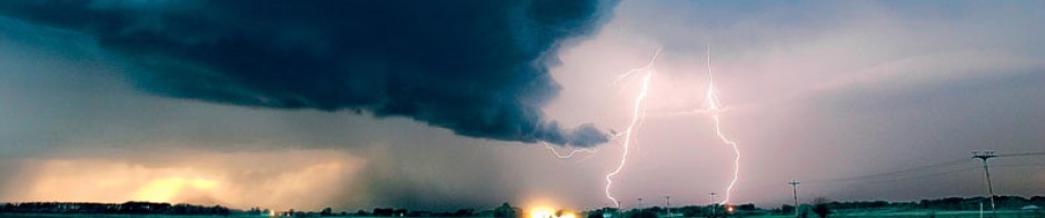
“At your 12 o’clock position for 100 miles is an an area of embedded thunderstorms from 50 miles south southeast of Austin to 75 miles north northwest of Dallas to 30 miles west southwest of Little Rock to 20 miles north of Houston to 50 miles southeast of Austin, tops to 41,000 feet with hail to 2 inches and severe turbulence, moving south at 15 knots.”
 Okay. So now I’m supposed to use that information for choosing an alternate route. Paul Bertorelli’s latest Insider Blog on AVweb titled “Sweaty Palms Over California” describes this as being “like someone telling you how to preform an appendectomy over the phone.” Unwilling to attempt that surgery, I can ask the air traffic controller (who can “paint” the weather on his radar) to vector me around the storms. But no matter what I do, I’m effectively blind. All I can see ahead of the airplane is a band of ominous clouds. Clouds can’t hurt me. But what’s in them can, and I have no clue where the really bad stuff is.
With an onboard weather radar, common equipment in airliners and corporate jets, I can paint the storms on my radar scope and assume responsibility for my own navigation around them. But this requires careful “tuning” of the radar controls and a sort of “sixth sense” about what the radar picture should look like. Under certain conditions, an area that appears to be clear of violent weather can in fact be filled with it.
 Fast forward to current day. NEXRAD (Next-Generation Radar) is a network of 159 high-resolution Doppler Weather Radars operated by the National Weather Service, an agency of the National Oceanic and Atmospheric Administration (NOAA) within the United States Department of Commerce.
NEXRAD detects atmospheric movement or wind. It returns data which when processed can be displayed in a mosaic map which shows variations in precipitation.The information is sent to satellites, which return it to earth.
Even in my small experimental airplane, I can view these color digital images of storms and their relationship to my planned route of flight. The information is never more than a few minutes old, and the contribution to pilot situational awareness and flight safety cannot be overestimated. Decison-making as to route of flight, diversion to an alternate airfield, and fuel planning is now transferred to me in the cockpit without having to rely on air traffic control for crucial information.
 I also have immediate access to weather data for any point in the US with a reporting capability. If I decide to divert to an alternate airfield not included in my original weather briefing, I can view on the cockpit display in text format the current observation and forecast for that location to assist me in planning for the approach and landing. I don’t have to change radio frequencies, request the information, copy it down, interpret it and then decide what to do with it. One click and there it is. To say this reduces pilot workload is an understatement at best.
At my age, many things tempt me to wish for the good old days. But in terms of weather in the cockpit, I like today just fine, thank you very much.
Comments
Weather in the Cockpit — No Comments
HTML tags allowed in your comment: <a href="" title=""> <abbr title=""> <acronym title=""> <b> <blockquote cite=""> <cite> <code> <del datetime=""> <em> <i> <q cite=""> <s> <strike> <strong>